

A Bike System for All Silicon Valley: Equity Assessment of Bike Infrastructure in San José, CA
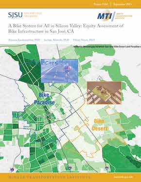
Investing in sustainable, multimodal infrastructure is of increasing importance throughout the United States and worldwide. Cities are increasingly making strategic capital investment decisions about bicycle infrastructure—decisions that need planning efforts that accurately assess the equity aspects of developments, achieve equitable distribution of infrastructures, and draw upon accurate assessment methods. Toward these efforts, this project uses a granular bike network dataset with statistical and geospatial analyses to quantify a bike infrastructure availability score (i.e., bike score) that accounts for the safety and comfort differences in bike path classes in San José, California. San José is the 10th largest U.S. city and a growing tech hub with a booming economy, factors that correlate with increased traffic congestion if adequate multimodal and active transportation infrastructure are not in place. Therefore, San José has been keen on becoming “one of the most bike-friendly communities in North America.” The City’s new plan, which builds on its first bike plan adopted in 2009, envisions a 557-mile network of all-ages-and-abilities bikeways to support a 20% bicycle mode split (i.e., 20% of all trips to be made by bike) by 2050. Hence, San José makes a perfect study area for piloting this project’s methodology for accurately assessing the equity of urban bike plans and infrastructures. The project uses the above-mentioned bike score (representing the bike infrastructure supply status) and San José residents’ bike travel patterns (to show bike trip demand status) utilizing StreetLight data to answer the following questions: (1) Where are San José's best (bike paradise) and worst (bike desert) regions for cycling? (2) How different are the socioeconomic attributes of San José’s bike desert and paradise residents? (3) Has San José succeeded in achieving an equitable infrastructure distribution and, if so, to what extent? And, (4) has the availability of infrastructure attracted riders from underserved communities and, if so, to what extent? Using the bike infrastructure availability score, this research measures and maps the City of San José's best and worst regions for cycling through geospatial analyses to answer Question 1 above. Further spatial and statistical analyses including t-tests, Pairwise Pearson correlation analysis, descriptive analysis, spatial visualization, principal component analysis (PCA), and multiple regression models to answer Questions 2, 3, and 4. In addition to this report, the findings are used to develop an open access web-tool, the San José Bike Equity Web Map (SJ-BE iMap). This research contributes to the critical assessment and planning efforts of sustainable, multimodal infrastructure in California and beyond.
In order to transfer the results of this project, we also developed a tool that is publicly available to use on the following webpage: https://arcg.is/Pen1n1. This tool allows for the assessment of San José’s socioeconomic attributes at the neighborhood level with respect to our bike score, as well as bike desert and paradise areas. The tool supports further planning and policy actions by presenting the location of bike deserts at the granular level. Furthermore, it provides spatial visualization of bike paradises and deserts vis-à-vis the socioeconomics of a neighborhood’s residents. This visualization allows planners and policymakers to identify the locations where the more marginalized communities are not provided access to quality bike infrastructures in San José. Thus, this tool supports the City of San Jose’s key goal for the Better Bikeways Project that aims for the equitable allocation of bike infrastructure.
AHOURA ZANDIATASHBAR, PHD
Dr. Zandi(atashbar) is an Urban and Regional Planning Assistant Professor and Co-Founder/Co-Director of the Spatial Analytics and Visualization Institute (SAVI), and the Founder of the MS GISc program at San José State University (SJSU) where his research focuses on micro-level analysis of U.S. high-tech zones and the role of urban form in the equitable robust knowledge economy and healthy communities. Dr. Zandi has authored more than 20 peer-reviewed articles and a book, Urban High-Tech Zones. He is the winner of People’s Choice Best Research Award from the Association of Collegiate Schools of Planning and the First Place Award from the United States Environmental Protection Agency in the 2015 Campus RainWorks Challenge.
JOCHEN ALBRECHT, PHD
Jochen Albrecht is a professor of computational geography at Hunter College, City University of New York. His general research centers on the modeling and analysis of spatio-temporal phenomena. On the transportation side, Dr. Albrecht specializes on multi-model modeling in realistic (complex) settings that allow decision makers to explore policy options. He is renowned for his work on standardizing geospatial workflows, which forms the basis of his third monograph in addition to his 56 peer-reviewed publications. Jochen serves on the board of directors for the Urban and Regional Information Systems Association, the GIS Certification Institute, and the California Geographic Information Association.
HILARY NIXON, PHD
Dr. Nixon is Deputy Executive Director for the Mineta Transportation Institute and a faculty member in the MS Transportation Management program at San José State University. She specializes in transportation and environmental planning and policy, and her research focuses primarily on the factors that influence pro-environmental behavior and the relationship between transportation and the environment. She earned a BA from the University of Rochester and a PhD in Planning, Policy, and Design from the University of California, Irvine.
-
Contact Us
San José State University One Washington Square, San Jose, CA 95192 Phone: 408-924-7560 Email: mineta-institute@sjsu.edu
