- 408-924-7560
- mineta-institute@sjsu.edu
- Donate
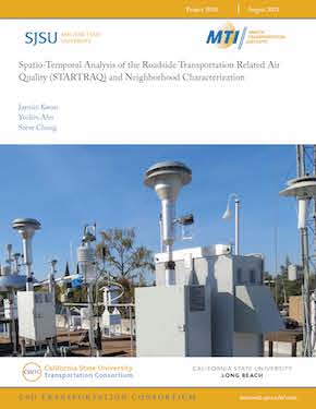
Spatio-Temporal Analysis of the Roadside Transportation Related Air Quality (STARTRAQ) and Neighborhood Characterization
To promote active transportation modes (such as cycling and walking), and to create safer communities for easier access to transit, it is essential to provide consolidated data-driven transportation information to the public. The relevant and timely information from data facilitates the improvement of decision-making processes for the establishment of public policy and urban planning for sustainable growth, and for promoting public health in the region. For the characterization of the spatial variation of transportation-emitted air pollution in the Fresno/Clovis neighborhood in California, various species of particulate matters emitted from traffic sources were measured using real-time monitors and GPS loggers at over 100 neighborhood walking routes within 58 census tracts from the previous research, Children’s Health to Air Pollution Study - San Joaquin Valley (CHAPS-SJV).
Roadside air pollution data show that PM2.5, black carbon, and PAHs were significantly elevated in the neighborhood walking air samples compared to indoor air or the ambient monitoring station in the Central Fresno area due to the immediate source proximity. The simultaneous parallel measurements in two neighborhoods which are distinctively different areas (High diesel High poverty vs. Low diesel Low poverty) showed that the higher pollution levels were observed when more frequent vehicular activities were occurring around the neighborhoods. Elevated PM2.5 concentrations near the roadways were evident with a high volume of traffic and in regions with more unpaved areas. Neighborhood walking air samples were influenced by immediate roadway traffic conditions, such as encounters with diesel trucks, approaching in close proximity to freeways and/or busy roadways, passing cigarette smokers, and gardening activity. The elevated black carbon concentrations occur near the highway corridors and regions with high diesel traffic and high industry.
This report provides consolidated data-driven transportation information to the public including:
1. Transportation-related particle pollution data
2. Spatial analyses of geocoded vehicle emissions
3. Neighborhood characterization for the built environment such as cities, buildings, roads, parks, walkways, etc..
JAYMIN KWON
Dr. Jaymin Kwon is an associate professor in the Department of Public Health and Environmental/Occupational Health and Safety option coordinator. He obtained his BS. and MS in Food Engineering and Biotechnology at Yonsei University, Korea and MS and PhD in Environmental Sciences at Rutgers University. He joined Fresno State in 2011. His research focuses on the epidemiological human exposure assessment to traffic emissions and adverse health effects, the development of sensors for air pollution monitoring, and the impact of traffic emission in under-represented microenvironments. His previous research assesses the exposure to traffic-emitted air pollutants on the different populations in Fresno, depending on their mode of transportation and the built environment of their community. His work characterizes the concentration of air pollutants, including particulate matters, polycyclic aromatic hydrocarbons, black carbon, and nitrous oxides near roadways and various commuting activities and microenvironments.
YUSHIN AHN
Yushin Ahn is an assistant professor of the Department of Civil and Geomatics Engineering, California State University at Fresno, CA. He received a B.Eng. Degree in civil engineering and a MS degree in surveying and digital photogrammetry from Inha University, Korea in 1998 and 2000, and the MS and PhD degree in geodetic science from the Ohio State University, Columbus, in 2005 and 2008 respectively.
His research interests include digital photogrammetry, feature tracking, and sensor calibration and integration. Dr. Ahn received the Robert E. Altenhofen Memorial Scholarship from the American Society of Photogrammetry and Remote Sensing. He has been a certified Photogrammetrist since 2014.
STEVE CHUNG
Dr. Steve Chung is an associate professor in the Department of Mathematics at California State University, Fresno. He received his BS in Applied Mathematics at CalPoly Pomona and PhD in Statistics from Florida State University. His research focuses on time series analysis and applied statistics.
-
Contact Us
San José State University One Washington Square, San Jose, CA 95192 Phone: 408-924-7560 Email: mineta-institute@sjsu.edu


