

Scoring Equitable Transit: A Data-Driven Framework for Affordable Transit-Oriented Development in California
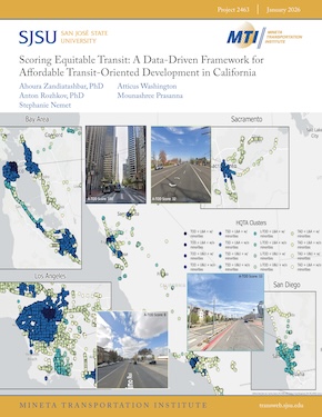
Transit-Oriented Development (TOD) is a cornerstone of California’s climate and land use policy, promising walkable, compact neighborhoods near high-quality transit. However, these benefits are not always distributed equitably. This study introduces a scalable framework for identifying and scoring Affordable Transit-Oriented Development (A-TOD) across the state’s High-Quality Transit Areas (HQTAs). The goal is to equip policymakers, planners, and housing agencies with tools to evaluate station areas based on their physical form, affordability, and equity outcomes. Using a 1.5-mile network-based pedestrian buffer around over 66,000 transit stations, the research team developed a three-stage clustering and scoring system. Station areas were classified by built environment characteristics, modeled housing and transportation cost burdens, and social vulnerability indicators, including minority population concentration. Each station received a composite raw score (0.5 to 6), which was normalized to a 0–100 scale to create an accessible equity index. Key findings reveal that while most HQTA stations are nominally affordable, nearly all are located in historically marginalized or currently vulnerable communities. High-scoring station areas tend to cluster in dense urban cores such as Los Angeles, Oakland, and Sacramento, while lower scores are concentrated in exurban and auto-oriented regions such as the Inland Empire and northern San Diego. These insights underscore the need for policy interventions that align transit investments with affordability and racial equity. The resulting typology and web-based equity map provide a powerful planning tool for guiding equitable development, CEQA streamlining, and preserving transit-oriented housing across California.
Dr. Ahoura Zandiatashbar
Dr. Ahoura Zandiatashbar is an Associate Professor of Urban and Regional Planning at San José State University (SJSU) and the Founding Director of the Spatial Analytics and Visualization Institute (SAVI). His research focuses on the intersection of urban analytics, active transportation, and spatial equity, with a particular emphasis on using GIScience to inform policy and infrastructure planning. Dr. Zandiatashbar’s work integrates data-driven methods with community-engaged research to support inclusive and sustainable urban development.
Dr. Anton Rozhkov
Dr. Anton Rozhkov is an Industry Assistant Professor and Director of the MS Program in Applied Urban Science and Informatics at the Center for Urban Science and Progress (CUSP) at Tandon School of Engineering at New York University. His research explores how data-driven policies, spatial analytics, and emerging technologies can transform urban infrastructure and planning.With a Ph.D. in Urban Planning and Policy from the University of Illinois Chicago, Dr. Rozhkov specializes in complex systems and the role of decentralized, renewable energy in city design. His research and teaching focus on geographical information systems (GIS), spatial analysis, decision modeling, and machine learning, helping uncover the “why” behind urban patterns to build more sustainable and equitable cities.
Stephanie Nemet
Stephanie Nemet is a master’s student in Geographic Information Science (GISc) at SJSU. Her thesis research explores the intersection of affordable housing and transit-oriented development (TOD). She has contributed to numerous projects with the Spatial Analytics and Visualization Institute (SAVI), focusing on public transit, public health, and vulnerable communities. As the student GIS lead for the City of San José, she played a key role in expanding the BayWheels bike-share program into East San José. Her work is driven by a passion for reducing auto-dependency and promoting sustainable, equitable urban environments.
Atticus Washington
Atticus Washington is a transportation engineer/planner with two years of professional experience in California. Atticus has transportation planning experience, specifically in travel demand modeling, SB 743, and big data analytics. He has contributed towards planning projects of varying sizes ranging from general plan updates to vehicle miles traveled (VMT) impacts all throughout the state of California. He holds a Bachelor's degree in civil engineering with a minor in sustainability in the built environment from the University of California, Davis.
Mounashree Prasanna
Mounashree Prasanna is a graduate student in Data Analytics with a strong interest in working with data to uncover patterns and communicate insights through visualization. She is passionate about using data not only for analysis but also for building intuitive and engaging tools that make information more accessible. Her academic and project experience spans data analysis,visualization, and web-based applications, with a focus on applying these skills to solve real-world problems.
For the A-TOD project, Mounashree contributed to the creation of interactive webmaps, combining geospatial data with modern visualization techniques. She focused on ensuring that the maps were informative, user-friendly, and capable of highlighting key insights effectively.
Mounashree is particularly motivated by projects that bridge data with storytelling, where complex datasets can be transformed into platforms that support learning, decision-making, and exploration. She continues to expand her skills in analytics and visualization with the goal of contributing to impactful data-driven solutions in both academic and professional settings.
-
Contact Us
San José State University One Washington Square, San Jose, CA 95192 Phone: 408-924-7560 Email: mineta-institute@sjsu.edu
