
- 408-924-7560
- Email MTI
- Individual Giving
- Corporate & Foundation Giving

Enhancing Wildfire Resilience in the Rail Industry: Developing a Community Resilience Extreme Events Portal (CREEP)
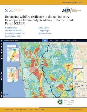
Abstract:
The Community Resilience Extreme Events Portal (CREEP) provides a centralized platform for accessing wildfire danger indices, critical asset locations, and vulnerability scores for rail segments. The project team developed a data-driven, indicator-based vulnerability assessment framework that defines vulnerability as a function of exposure, sensitivity, and adaptive capacity. To build this framework, the team selected publicly available datasets, prioritizing national datasets whenever possible to ensure transparency, reproducibility, and scalability. The portal allows users to analyze and visualize vulnerability across 1-kilometer segments of Class I freight and passenger rail lines in California, supporting planning and mitigation prioritization to help reduce rail-related fatalities, injuries, economic losses, and service disruptions caused by wildfire.
To inform development, the team held three stakeholder working sessions with representatives from government agencies, rail operators, and research institutions. Participants provided feedback on data relevance and practical applications and emphasized the need for integration with existing systems and improved coverage for under-resourced regions. Stakeholders also suggested incorporating infrastructure material types, electrified rail risks, and scoring based on proximity or cargo type. The team integrated the vulnerability framework into Pacific Disaster Center's DisasterAWARE platform, allowing users to view the data driving the vulnerability assessment framework in combination with the entire DisasterAWARE system. This integration improves coordination and decision-making capabilities while supporting the broader goal of building a more adaptive and resilient rail system.
Check out this training video to learn more about CREEP. You are also invited to check out the Pacific Disaster Center's DisasterAware portal. Please request a login if you don't already have one.

Authors:
Karl Kim
Dr. Karl Kim is a professor at the University of Hawaii, Department of Urban and Regional Planning, who has over 40 years of experience in transportation safety and security, and disaster and risk management. Dr. Kim is Executive Director of the National Disaster Preparedness Training Center (NDPTC), a member of the National Domestic Preparedness Consortium (NDPC), FEMA’s premier training provider. NDPTC is a FEMA training center authorized to develop and deliver nationwide disaster preparedness, mitigation, and recovery training. Dr. Kim is the Editor-in-Chief of the Transportation Research Interdisciplinary Perspectives, Associate Editor of Transportation Research, Part D, Transport and Environment, and formally the Editorin- Chief of Accident and Prevention journals. Dr. Kim serves on several committees of the Transportation Research Board and was elected to the Board of the North American Alliance of Hazards and Disaster Research Institutes (NAAHDRI). Dr. Kim is also director of the University of Hawaii’s University Transportation Center (UTC), which is a member of the Pacific Southwest Region (PSR) University Transportation Center. Dr. Kim and the University of Hawaii are members of the Center for Surface Transportation Testing and Academic Research (C-STTAR) consortium. This consortium of eight (8) universities and academic research centers was established to provide expertise in research focus areas across all modes of surface transportation to support the Federal Railroad Administration’s Transportation Technology Center’s (TTC) growth initiatives.
Daniele Spirandelli
Dr. Daniele Spirandelli is an environmental planner with over 20 years of experience leading teams in engineering, science, and planning, including 10 years focused on vulnerability assessments for transportation and utilities across the Pacific Northwest, California, and Hawaiʻi. She is currently leading a hazard vulnerability assessment for coastal transportation infrastructure in the State of Washington to identify areas for nature-based solutions to mitigate risks. Previously, as faculty at Hawaiʻi Sea Grant College and the University of Hawaiʻi, she created tools and strategies for sea level rise resilience with local communities and agencies. During her PhD work at the University of Washington’s Urban Ecology Research Lab, she conducted regional studies, including her dissertation: a comprehensive, 10-county empirical analysis of land use, infrastructure, land cover change, and habitat impacts. Dr. Spirandelli is an active educator and collaborator on adaptation and resilience.
David Rother
Dr. David Rother is a dedicated wildfire resilience consultant with two years of professional experience in the field. He is currently working on a vulnerability assessment of rail systems to wildfire and is developing a web portal to help the Federal Railway Association, railroads, and communities reduce risks. During his PhD work at San Diego State University and the University of California, Santa Barbara, he conducted research on the effects of wildfire on energy balance, the influence of burn severity on post-fire vegetation recovery, and the impacts of extreme fire weather. Dr. Rother has extensive knowledge of the drivers of wildfire activity, and has years of experience managing, processing, and analyzing geospatial datasets and utilizing tools to understand wildfire.
Michelle Toner
Ms. Michelle Toner is a licensed GIS Professional (GISP) with more than eight years of experience managing spatial data and visualizing spatial information related to emergency management, environmental remediation, and resilience. She specialized in complex hazard assessments at the intersection of risk and infrastructure systems. She develops web mapping products, presentation graphics, and report figures to illustrate specific assets and hazard vulnerabilities. Michelle leverages existing spatial information and develops spatial data with clients; she also contributes to the development of complex spatially driven indicators for vulnerability analysis and reporting.
Eric Yamashita
Dr. Eric Yamashita has more than 35 years of experience in applying geospatial and remote sensing technologies and data products, and implementing and integrating information technology systems into organizations. Mr. Yamashita is the Associate Director of Technology and Innovation of the National Disaster Preparedness Training Center (NDPTC) at the University of Hawaii. Mr. Yamashita has over 50 peer-reviewed publications in the application of spatial science, transportation safety, disaster risk assessment, and urban transportation planning.
Chris Chiesa
Mr. Chiesa has more than 35 years of experience developing and managing enterprise applications of space-based and geospatial information technologies, and has been actively involved in disaster management activities around the globe for the past two decades. As the Director of Early Warning Solutions at the Pacific Disaster Center, he has helped to deliver DisasterAWARE-based systems to a number of countries as well as build skills and capacity for the operational use of the PDC-hosted DisasterAWARE Pro platform for many more partner organizations. In 2002, PDC received the prestigious Sasakawa Award from the United Nations for the Center’s DisasterAWARE platform and its work on a multi-hazard risk reduction approach.
Greg Hampe
Mr. Hampe developed enterprise software and systems for over 20 years with the American Red Cross Disaster Response and Biomedical groups. Having also spent several years as an Assistant Professor of Information Systems and Operations Management at George Mason University's Costello College of Business, including serving as Academic Director for two graduate programs, he then joined the Pacific Disaster Center as part of the Applied Science team to enhance and expand the DisasterAWARE platform. During his time with PDC, he has worked closely with Chris Chiesa and a variety of global projects, including a partnership with NASA on implementing global flood and landslide hazards.
Published:
August 2026
Keywords:
Wildfires
Rail transit
-




Contact Us
San José State University One Washington Square, San Jose, CA 95192 Phone: 408-924-7560 Email: mineta-institute@sjsu.edu

