- 408-924-7560
- mineta-institute@sjsu.edu
- Donate
Ten Years Forward: An Evaluation of California’s Active Transportation Program
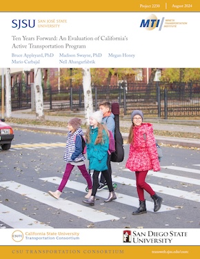
California’s Active Transportation Program (ATP) is a competitive, grant-based program that serves as a major funding stream for active transportation infrastructure in California. The program has six goals based on increasing nonmotorized transportation, safety, equity, sustainability, and health. Evaluation of the ATP’s administrative and scoring processes is crucial to ensure goals are met as equitably and efficiently as possible. Additionally, establishing a methodology for evaluating the safety impacts of active transportation projects is critically important. Through a series of interviews and an extensive review of the documents and rubrics of the program, this report discusses how the Active Transportation Program prioritizes and funds active transportation projects. California’s Active Transportation Program can serve as a model for other states, regions, and localities to follow. Building from this approach, the research team poses questions and considerations that could lead to program improvements, including increasing funding for the program, improving data collection, facilitating the funding of a larger number of smaller projects, and expanding long-term monitoring. After evaluating the program using qualitative methods, the research team quantitatively assessed the benefits of funded and completed projects. Variables in the proposed model included social equity, safety, urban form, active transport use, automobile dependence, existing facilities, street design, and land use.
BRUCE APPLEYARD, PHD
Dr. Appleyard is a Professor in City and Regional Planning and Public Administration at SDSU, with expertise in geo-spatial analysis, behavioral economics, econometrics, applied transportation, land use policy analysis, and in designing and creating livable streets and facilities for pedestrians and bicyclists. Dr. Appleyard is also the SDSU Director of the National Center for Pedestrian and Bicyclist Safety (CPBS) and SDSU's Active Transportation Research Center. Dr. Appleyard has led several research efforts examining the relationship between the built environment, transportation, land use, socioeconomics, and a variety of outcomes related to public health, sustainability, economic vitality, livability, and social behaviors. For the past three years, Dr. Appleyard has led the travel surveys and transportation elements for successive Climate Action Plans for San Diego State University. He was the Project Lead for the development of the Livability Calculator for the National Academies of Sciences. This required an extensive geospatial and econometric, mixed-method analysis of performance indicators for all transit stations and corridors throughout the US. Dr. Appleyard has also been the project lead for the development of the Smart Mobility Calculator for Caltrans. In sum, Dr. Appleyard’s experience, both academically and professionally, uniquely qualifies him to lead this project.
MARIO CARBAJAL
Mario Carbajal is a Master of City Planning student at San Diego State University. As a graduate assistant at the university, he contributes to studies on transportation and public health. His studies in planning focus on housing, accessibility, a walkable city, and land use. He completed a Bachelor of Science degree in Natural Resource Policy at Oregon State University. Mario has experience conducting research and creating technical reports.
MADISON SWAYNE, PHD
Dr. Swayne is an Assistant Professor of City Planning in the School of Public Affairs at San Diego State University. She uses mixed methods including big data, automated computing methods, and primary data sources to answer research questions at the intersection of environmental justice and land use. Her research examines how transportation planning and infrastructure can serve to promote spatial equity through access to neighborhood resources including grocery stores and other food retailers, jobs, and parks. She has extensive experience in building and analyzing spatial data. Dr. Swayne has additional experience leading policy evaluation including an analysis of the California Environmental Quality Act (CEQA) and California’s AB617 Community Air Protection Program and their efficacy in environmentally overburdened communities.
NELL AHANGARFABRIK
Nell Ahangarfabrik is a Master of City Planning student at San Diego State University. As a graduate research assistant at the university, she contributes to various projects on transportation and safety. She also works as a long-range planner at the County of San Diego. Nell has extensive experience with geospatial analysis and coding, including GIS analysis and mapping.
MEGAN HONEY
Megan Honey is a Master of City Planning student at San Diego State University. As a graduate researcher, she contributes to various transportation-related projects. She completed a Bachelor of Arts degree in Environmental Science and Policy at California State University Long Beach. Megan has extensive experience conducting all aspects of research, including GIS analysis and literature reviews.
-
Contact Us
San José State University One Washington Square, San Jose, CA 95192 Phone: 408-924-7560 Email: mineta-institute@sjsu.edu


