- 408-924-7560
- mineta-institute@sjsu.edu
- Donate

Commute Duration Dashboard Guide: Mapping Commute Travel Times to Evaluate Accessibility
Abstract:
Transportation planning is shifting from mobility-based to accessibility-based analysis. Mobility-based planning evaluates transportation system performance based primarily on travel speed. Accessibility-based planning evaluates system performance based on time, the amount of time required to access desired services and activities such as work, school and shops. Accessibility-based planning recognizes that many factors can affect accessibility, including mobility (travel speed), proximity (the distances between destinations, and therefore development density and mix), transport system diversity (the variety of travel modes available at a time and place), transport network connectivity (the quality of connections between modes), and affordability.
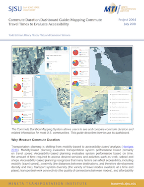
A simple but useful accessibility indicator is trip duration, the amount of time that people spend traveling to destinations. Commute duration data—the number of minutes that workers spend traveling to their jobs—is available in the United States from the U.S. Census. Our Commute Duration Mapping website presents this and related information for most U.S. communities. This guide provides an overview of this mapping system’s controls.
Publications:
Authors:
TODD LITMAN
Todd Litman is founder and executive director of the Victoria Transport Policy Institute, an independent research organization dedicated to developing innovative solutions to transport problems. His work helps expand the range of impacts and options considered in transportation decision-making, improve evaluation methods, and make specialized technical concepts accessible to a larger audience. His research is used worldwide in transport planning and policy analysis.
HILARY NIXON, PHD
Dr. Nixon is Deputy Executive Director of the Mineta Transportation Institute and a faculty member in the MS Transportation Management program at San José State University. She specializes in transportation and environmental planning and policy, and her research focuses primarily on the factors that influence pro-environmental behavior and the relationship between transportation and the environment. She earned a BA from the University of Rochester and a PhD in Planning, Policy and Design from the University of California, Irvine.
CAMERON SIMONS
Cameron Simons is a Housing Data Analyst at Kukun. He previously worked for the City of San José’s Department of Transportation and as a Research Assistant for the Mineta Transportation Institute. He holds a MS in Data Science and a BS in Economics from San José State University.
Published:
July 2021
Keywords:
Digital mapping
Commuters
Travel time
-
Contact Us
San José State University One Washington Square, San Jose, CA 95192 Phone: 408-924-7560 Email: mineta-institute@sjsu.edu
