- 408-924-7560
- mineta-institute@sjsu.edu
- Donate
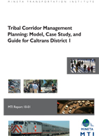
Tribal Corridor Management Planning: Model, Case Study, and Guide for Caltrans District 1
In Northern California, tribal governments and personnel of the California Department of Transportation (Caltrans) District 1, have applied innovative context-sensitive solutions to meet a variety of transportation challenges along state highways that traverse tribal lands. This report describes and discusses the efforts under way and offer suggestions for continuing and extending these initiatives through the development of Tribal Corridor Management Plans (TCMPs). The methods employed in this project are multidisciplinary and include: (1) content analysis of existing corridor management plans; (2) literature review to identify “best practices;” (3) participant observation; (4) interviews with local stakeholders; (5) focus group interviews with Caltrans personnel; and (6) landscape analysis. This study’s authors conclude that Caltrans District 1 staff and tribal governments share common goals for highway operations; however, progress —while significant—has been somewhat hampered by geographic and administrative challenges. It is recommended that Caltrans and the tribes seek early and frequent communication and collaboration to overcome these obstacles. Further, they identify several examples of non-standard design elements that could be incorporated into highway improvements to enhance local sense of place among both residents and travelers. A preliminary TCMP for the segment of State Route 96 that lies within the boundaries of the Hoopa Valley Indian Reservation is presented as an example. Beyond its role as a guide for initiating tribal corridor projects within Caltrans District 1, the report should prove instructive for any efforts to enhance sense of place within transportation byways, particularly in Native communities.
JOY K. ADAMS, PhD
Joy K. Adams is a Senior Researcher at the headquarters of the Association of American Geographers in Washington, DC, where she contributes to projects related to professional development and careers for geographers, geographic education, and diversity within the discipline. She was previously Associate Professor of Geography at Humboldt State University, where she taught a variety of human geography courses from 2006-2010. Her research and teaching have focused on the social construction of ethnic and racial identities in the United States, cultural landscapes of North America, heritage tourism, and qualitative methods. During her time in Humboldt County, Joy was a member of the North Coast Geotourism Committee, and she and her students were actively involved with the development of the recently launched Redwood Coast Geotourism MapGuide.
MARY SCOGGIN, PhD
Mary Scoggin is Professor of Anthropology at Humboldt State University, where she has taught anthropology, folklore and Chinese studies since 1998. Her research focuses upon symbolic representation in contemporary Chinese society, including cultural and political identity. She has written articles on Chinese aesthetics, bureaucracy and media, and Chinese American media policies and publications. She has conducted research on local politics and identity in Humboldt County. Related to this work she spent three years as a member of the Humboldt County Association of Governments Citizen Advisory Committee.
-
Contact Us
San José State University One Washington Square, San Jose, CA 95192 Phone: 408-924-7560 Email: mineta-institute@sjsu.edu


